In 2013, researchers at the University of Texas at Austin demonstrated something unsettlingly precise: they successfully 'spoofed' a superyacht's GPS receiver, subtly altering its displayed course without anyone onboard noticing. This wasn't some Hollywood hack; it was a clear demonstration of just how deeply our lives rely on the Global Positioning System, and how exquisitely precise, yet potentially vulnerable, its signals are. We trust GPS implicitly, whether we're navigating unfamiliar streets, tracking a package, or even calling for emergency services. But have you ever stopped to truly consider how GPS knows your exact location? It's a marvel of engineering and physics, happening invisibly above our heads.
The Invisible Orchestra: Satellites, Signals, and Your Exact Location
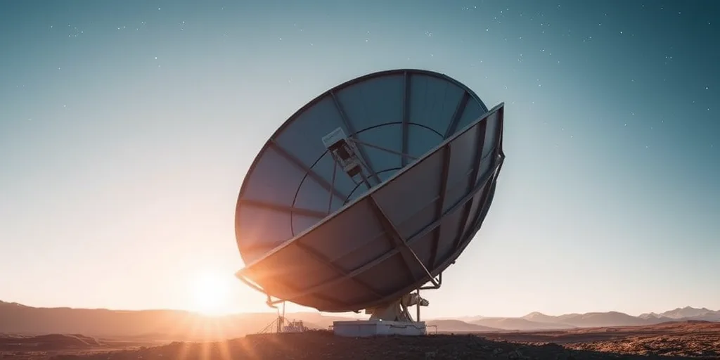
At its core, the Global Positioning System isn't just one thing; it's a vast, global utility, maintained by the U.S. Space Force. It consists of three main segments: the space segment, the control segment, and the user segment. The space segment is what most people picture: a constellation of satellites orbiting Earth, constantly broadcasting signals. Today, the U.S. Space Force operates a minimum of 31 active GPS satellites, ensuring robust global coverage and redundancy.
These satellites aren't just floating aimlessly; they're in precise medium Earth orbits, about 12,550 miles (20,200 kilometers) above the Earth's surface. Each satellite circles the Earth twice a day, on one of six different orbital planes. This strategic arrangement ensures that, at any given moment, a GPS receiver on Earth can "see" at least four satellites, often more. Seeing these multiple satellites is absolutely critical for how GPS knows your exact location.
Each satellite broadcasts a continuous radio signal, containing two crucial pieces of information: its precise position in space (called ephemeris data) and the exact time the signal was sent. Your phone, car's navigation system, or wearable device acts as a GPS receiver, passively listening for these signals. It doesn't send anything back to the satellites; it only receives. Think of it like a one-way conversation where you're just listening to multiple speakers shouting out their location and the time, and you're trying to figure out where you are based on their messages.
Atomic Clocks and the Speed of Light: The Heart of GPS Precision
Here's the thing: the magic of GPS hinges on incredibly precise timing. Every GPS satellite carries multiple atomic clocks onboard – typically rubidium and cesium clocks – which are among the most accurate timekeeping devices known to humanity. These clocks are so precise they lose only about one second every 300,000 years. This extreme accuracy is non-negotiable because GPS relies on measuring tiny differences in the arrival time of signals.
When your GPS receiver picks up a signal from a satellite, it records the exact time the signal arrived. It already knows the time the signal was sent because that information is embedded in the signal itself. By subtracting the sent time from the received time, your device calculates the travel time of the radio signal. Since radio waves travel at the speed of light (approximately 186,000 miles or 300,000 kilometers per second), your receiver can then easily calculate the distance to that satellite using the simple formula: distance = speed x time.
For example, if a signal took 0.06 seconds to reach your receiver, you're approximately 11,160 miles from that satellite. But wait, if your device’s clock isn’t perfectly synchronized with the satellite’s atomic clock, this calculation will be slightly off. That’s where the need for multiple satellites comes in. Your device's relatively cheap quartz clock isn't nearly as accurate as the satellite's atomic clock, introducing a slight timing error. This constant, tiny error is precisely why your receiver needs at least four satellites to accurately determine its position.
The Atomic Clocks Behind the Stars
The synchronization of these atomic clocks across the entire GPS constellation is a monumental feat. Ground control stations around the world, part of the control segment, constantly monitor the satellites. They track their orbits with extreme precision and update the onboard atomic clocks, making tiny adjustments to keep them perfectly in sync. These ground stations also upload new navigation messages to the satellites, including updated ephemeris data (the precise orbital information) and clock corrections. Without this constant monitoring and adjustment, the minute drift in even atomic clocks would quickly degrade the accuracy of the entire system, making your "exact location" a wild guess.
It's Not Triangulation; It's Trilateration
Many people mistakenly refer to the GPS positioning process as "triangulation," but that's incorrect. Triangulation involves measuring angles, which isn't what GPS does. Instead, it uses a technique called **trilateration**, which involves measuring distances. Imagine you know your distance from three different points. You can then pinpoint your exact location in 3D space.
Here’s how it works: knowing your distance from one satellite tells you that you are somewhere on the surface of an imaginary sphere, with the satellite at its center and the calculated distance as its radius. Knowing your distance from a second satellite narrows your possible location down to the circle where the two spheres intersect. Add a third satellite, and the intersection of all three spheres usually results in just two possible points in space. One of these points is often nonsensical (e.g., in outer space or deep underground), so your receiver can discard it, leaving one precise location.
But what about that timing error from your receiver's less-than-perfect clock? That's where the fourth satellite becomes essential. By solving a set of four equations simultaneously (one for each satellite), your receiver can not only determine its three-dimensional position (latitude, longitude, and altitude) but also calculate and correct its own clock's timing error. This self-correction mechanism is a brilliant design feature, allowing inexpensive receivers to achieve incredible precision without needing their own atomic clocks.
"GPS isn't just a technology; it's a fundamental shift in how we understand our place in the world. Its precision, born from atomic clocks and Einstein's relativity, empowers everything from farming to disaster relief." – Dr. Bradford Parkinson, often called the "father of GPS."
From Distortion to Pinpoint: Error Correction and Augmentation
Even with advanced trilateration and atomic clocks, the GPS signal isn't always perfect when it reaches your device. Several factors can introduce errors, slightly skewing your reported location. These include atmospheric delays, multipath interference, and subtle satellite clock errors that persist despite ground station corrections.
The Earth's atmosphere, particularly the ionosphere and troposphere, can slow down the GPS signals as they pass through. This delay can make it seem like the satellite is farther away than it actually is. Additionally, signals can bounce off buildings, mountains, or other objects before reaching your receiver. This "multipath interference" causes the signal to travel a longer path, again creating a false distance measurement. Standard GPS receivers typically achieve accuracy of about 5-10 meters, but these errors can sometimes increase that margin.
Mitigating the Sky's Interference
To counteract these issues and enhance accuracy, augmentation systems exist. One prominent example in North America is the Wide Area Augmentation System (WAAS), managed by the Federal Aviation Administration (FAA). WAAS uses a network of ground reference stations that know their exact locations with extreme precision. These stations monitor GPS signals, calculate the errors caused by atmospheric conditions and other factors, and then transmit these correction messages to geostationary WAAS satellites. These satellites then broadcast the corrected signals back to Earth, where WAAS-enabled GPS receivers can use them to significantly improve their accuracy. With WAAS, precision can often improve to 1-3 meters, making it vital for aviation and other critical applications.
Other augmentation systems include Europe's European Geostationary Navigation Overlay Service (EGNOS), Japan's Multi-functional Satellite Augmentation System (MSAS), and India's GPS-Aided Geo Augmented Navigation (GAGAN). These systems, collectively known as Satellite-Based Augmentation Systems (SBAS), demonstrate a global effort to refine and improve the reliability of satellite navigation for everyone.
Beyond the Satellites: Assisted GPS (A-GPS) and Modern Devices
While the satellite constellation forms the backbone, your smartphone's GPS isn't solely relying on those faint signals from space. Modern devices often employ Assisted GPS (A-GPS) to get a faster, more accurate fix on your location, especially in challenging environments like urban canyons or indoors. A-GPS leverages a blend of technologies.
When you turn on location services, your phone can use its cellular network connection to quickly download "assistance data" from a server. This data includes things like the current approximate location of satellites and their orbital paths, allowing your phone to know exactly where to "look" for signals, rather than having to scan the entire sky. This significantly speeds up the "time to first fix" – the time it takes for your device to determine your location. Without A-GPS, a cold start (where your device has no prior satellite information) could take minutes; with it, it's often mere seconds.
Furthermore, your phone integrates other sensors and data sources to refine its position. Wi-Fi positioning uses the known locations of Wi-Fi hotspots to estimate your position, particularly effective indoors where satellite signals struggle to penetrate. Cell tower triangulation (more accurately, multilateration based on signal strength and timing from multiple towers) provides a rough location estimate. Even internal sensors like accelerometers, gyroscopes, and compasses can contribute to dead reckoning, estimating your movement from a known point when GPS signals are temporarily lost. This fusion of data creates a much more robust and responsive location experience than a standalone GPS receiver could ever offer.
What This Means for You: Unpacking GPS's Everyday Impact
Understanding how GPS knows your exact location isn't just a technical curiosity; it illuminates the foundation of countless services we now consider indispensable. This invisible infrastructure underpins a vast portion of the digital economy and our daily lives. From the moment you order a ride-share to the precise timing for financial transactions, GPS plays an unseen but vital role. Its reliability has become a critical expectation, shaping everything from logistics to personal safety.
Consider the sheer economic impact. A 2019 study by the National Institute of Standards and Technology (NIST) estimated that the economic benefits of GPS to the U.S. economy alone totaled $1.4 trillion since its inception, with an ongoing annual benefit of $37 billion. That's a staggering figure, underscoring its pervasive influence. For you, this means:
- Seamless Navigation: Whether you're driving, cycling, or walking, GPS guides you with remarkable precision, reducing travel time and stress.
- Enhanced Safety: Emergency services can pinpoint your location rapidly during a crisis, often shaving critical minutes off response times.
- Logistics and Deliveries: Every package delivered, every fleet managed, relies on GPS for optimal routing and tracking.
- Precision Agriculture: Farmers use GPS to precisely plant seeds, apply fertilizers, and manage irrigation, increasing yields and reducing waste.
- Geotagging and Social Media: Your photos and posts carry location data, enriching your digital experiences and connecting you with local communities.
- Timing and Synchronization: Beyond location, the precise timing signals from GPS satellites synchronize power grids, financial networks, and cellular communications worldwide.
This complex dance of satellites, clocks, and algorithms creates the seemingly simple blue dot on your screen. It's a testament to human ingenuity and our unyielding quest to master our environment, giving us unprecedented awareness of where we are, and where we're going.
Frequently Asked Questions
Question
Why do I sometimes lose my GPS signal, especially indoors?
GPS signals are very weak radio waves, similar to faint whispers from space. They struggle to penetrate solid objects like building roofs, dense walls, or even thick tree canopies, which is why your phone often loses signal indoors or in heavily urbanized areas known as "urban canyons."
Question
Is GPS free to use?
Yes, the GPS service itself is provided by the U.S. government and is free for anyone in the world to use. While the hardware (your phone or GPS device) costs money, there are no subscription fees or charges for receiving the basic GPS signals.
Question
Can other countries track my location using GPS?
No, your GPS receiver only passively listens to signals from satellites; it doesn't transmit your location back to the satellites or anyone else. Your phone or device might share your location with apps or network providers, but that's a separate function, not inherent to the GPS technology itself.