In 2021, a study by pCloud revealed a striking statistic: location data is the most frequently collected data type, with 47% of apps gathering it from your phone. This isn't just about finding the nearest coffee shop or getting accurate directions; it's a profound, persistent digital footprint you leave everywhere you go. From tailored advertisements that pop up after you walk past a store to emergency services knowing your exact coordinates, your phone is a sophisticated beacon, constantly communicating its position to a complex ecosystem of satellites, cell towers, Wi-Fi networks, and even tiny Bluetooth transmitters. But how does this intricate system of location tracking actually work?
- Your phone uses a combination of GPS satellites, Wi-Fi signals, cellular towers, and Bluetooth beacons to determine its location with varying degrees of accuracy.
- Assisted GPS (A-GPS) significantly speeds up location fixes by using cellular data to pre-load satellite information, improving performance in urban environments.
- Apps and operating systems request and manage your location permissions, often sharing this data with third parties for analytics, advertising, and service improvement.
- Managing your phone's privacy settings, understanding app permissions, and using VPNs or location spoofing tools are crucial steps in controlling your digital footprint.
The Invisible Web: GPS and Satellite Triangulation
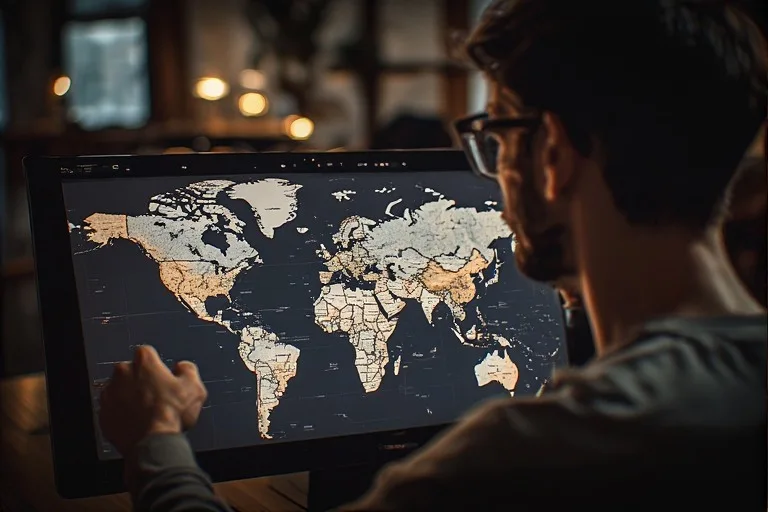
When most people think about how their phone knows where they are, they immediately think of GPS – the Global Positioning System. It's the gold standard for outdoor location accuracy, providing reliable coordinates almost anywhere on Earth. The premise is elegantly simple: a constellation of at least 31 active satellites orbits our planet, continuously broadcasting radio signals. Your phone, equipped with a GPS receiver, doesn't transmit anything back to these satellites; it passively listens.
To pinpoint your location, your phone needs to receive signals from at least four GPS satellites. Each signal carries a timestamp and the exact orbital position of the satellite at that moment. By measuring the slight delay in receiving these signals from multiple satellites, your phone can calculate the distance to each one. Imagine drawing spheres around each satellite, with the radius of each sphere representing the calculated distance. The point where these spheres intersect – or come closest to intersecting – is your precise location on the ground. This process, known as trilateration (not triangulation, which measures angles), allows for accuracy down to a few meters in ideal conditions.
But wait. What happens when satellites lose connection, say, when you're deep inside a building or in a dense urban canyon? GPS alone can struggle. That's where other technologies step in to assist, creating a more robust and resilient location service. Without these complementary systems, our digital maps and navigation apps wouldn't be nearly as seamless. You can learn more about What Happens When Satellites Lose Connection and its broader implications.
Beyond Orbit: Assisted GPS (A-GPS)
Pure GPS, while accurate, has a few drawbacks. It can be slow to acquire a "fix" because the phone needs to download an "almanac" and "ephemeris" – data sets detailing satellite orbits and health – directly from the satellites, which are transmitting at relatively low bandwidth. This process, known as a "cold start," can take several minutes. This isn't ideal when you're trying to quickly find your way on a busy street.
Enter Assisted GPS (A-GPS). This technology leverages cellular networks to significantly speed up the GPS process. When your phone requests a location, it can download the almanac and ephemeris data from a server provided by your cellular carrier. This server-assisted data is much faster to acquire than waiting for direct satellite broadcasts. Furthermore, A-GPS can provide an initial approximate location using cell tower information, helping the GPS receiver narrow down its search for satellite signals. This hybrid approach means your maps load faster, your location updates more frequently, and you get a much more reliable fix even in challenging environments like cities with tall buildings that obstruct satellite views.
Ground Control: Wi-Fi, Cell Towers, and Bluetooth Beacons
While GPS excels outdoors, it's often supplemented or even replaced by other methods, especially indoors or in densely populated areas. These ground-based systems offer faster fixes and can work where satellite signals can't penetrate.
Wi-Fi Positioning: Every Wi-Fi network broadcasts a unique identifier called a MAC address. Companies like Google and Apple have built massive databases mapping the physical locations of millions of these Wi-Fi access points. When your phone's Wi-Fi is enabled, it can scan for nearby networks, even if it's not connected to them. By comparing the MAC addresses of these detectable networks to its database, and measuring the signal strength (RSSI) from each, your phone can triangulate its position. This method is incredibly effective indoors and in urban areas where Wi-Fi networks are abundant, often providing accuracy down to a few meters.
Cellular Triangulation (Cell ID): Your phone is constantly communicating with nearby cell towers. Each tower has a unique Cell ID. By measuring the signal strength from multiple towers, and knowing the approximate locations of those towers, your phone can estimate its position. This is a coarser method than GPS or Wi-Fi, typically offering accuracy ranging from tens of meters in urban areas to several kilometers in rural environments. However, it's a ubiquitous backup, always available as long as you have cellular service. It's the primary way emergency services might get an approximate location if other, more precise methods fail.
The Hyperlocal Edge: Bluetooth Low Energy (BLE)
For truly granular indoor positioning, a newer player has emerged: Bluetooth Low Energy (BLE) beacons. These small, battery-powered devices are strategically placed in locations like retail stores, museums, airports, and hospitals. They continuously broadcast tiny data packets that can be picked up by your smartphone's Bluetooth receiver. Unlike Wi-Fi positioning, which relies on existing infrastructure, beacons are purpose-built for location services.
When your phone detects signals from several beacons, it can estimate its position based on the signal strength, similar to how Wi-Fi positioning works. This allows for hyper-accurate indoor navigation, guiding you to a specific product aisle, a gate at an airport, or even a particular artwork in a gallery. Retailers, for instance, love beacons because they can deliver highly contextual notifications or offers directly to your phone as you walk past relevant displays. This technology bridges the gap where GPS is useless and Wi-Fi might be too broad.
“The blend of location technologies on modern smartphones creates a surprisingly resilient and precise tracking ecosystem,” says Dr. Anya Sharma, Professor of Cybersecurity at Stanford University. “Our research shows that combining GPS with Wi-Fi and cellular data can achieve sub-meter accuracy in optimal conditions, but this precision comes with significant privacy tradeoffs. For example, a 2022 study by our lab found that even with anonymized datasets, 87% of individuals could be re-identified based on just four known location points.”
Software Smarts: Apps, Operating Systems, and Your Data
It's not just the hardware and network signals at play; the software on your phone is the conductor of this intricate orchestra. Your phone's operating system (iOS or Android) manages access to these various location technologies. When an app requests your location, the OS acts as a gatekeeper, determining which method to use and whether to grant the app access.
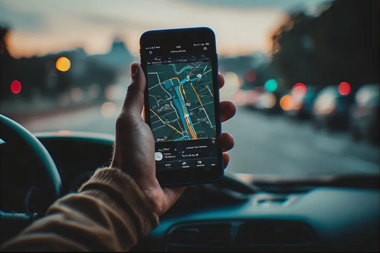
Consider a weather app. To tell you How Weather Apps Predict Rain So Accurately, it needs your current location. The OS will likely try A-GPS first for speed and accuracy. If you're indoors, it might fall back to Wi-Fi positioning. The OS then provides the estimated coordinates to the app. But here's the thing. Many apps don't just use your location for their stated purpose. They often collect, store, and sometimes share this data with third parties.
Marketing companies, data brokers, and even some government entities are keen on acquiring this highly valuable information. They use it to build detailed profiles of your habits, interests, and even your social connections. This data can inform targeted advertising, personalize services, or be aggregated for urban planning and traffic analysis. The permissions you grant to apps are crucial here – "Always Allow," "Allow While Using App," or "Ask Next Time" – each has significant implications for how continuously your location is tracked.
The Privacy Paradox: Who's Watching and Why
The convenience of location services is undeniable. We rely on them for navigation, finding nearby restaurants, ride-sharing, and even for health and fitness tracking. However, this convenience comes with a significant privacy cost. A Pew Research Center study in 2019 found that roughly eight-in-ten Americans say they are at least somewhat concerned about companies and advertisers accessing their data, with location data often topping the list of concerns.
Your location data, when aggregated over time, paints a detailed picture of your life. It can reveal where you live, work, worship, socialize, and even your medical appointments. This isn't theoretical; we've seen numerous instances of location data being misused, sold without explicit consent, or even accessed by law enforcement without a warrant. For example, in 2020, reports emerged of location data collected from various apps being sold to government contractors and then used for purposes far beyond what users might have expected.
The "why" behind this pervasive tracking is multifaceted. For app developers, it's often about improving user experience, personalizing content, or enabling core functionalities. For advertisers, it's about delivering highly relevant ads that increase conversion rates. For data brokers, it's about compiling vast datasets for sale to various industries. And for some, it's about security or public safety. The challenge lies in balancing these benefits against the fundamental right to privacy. The hidden systems behind online maps you use daily are part of this complex ecosystem, constantly evolving to deliver more accurate data while grappling with ethical considerations. Consider The Hidden Systems Behind Online Maps You Use Daily to better understand the scale of this data collection.
Battling the Beacons: Taking Back Control
While complete anonymity in the digital age is an elusive dream, you aren't powerless. Understanding how location tracking works is the first step toward managing your digital footprint. Here's a comparative look at the primary technologies involved:
| Technology | Primary Use Case | Typical Accuracy | Power Consumption | Signal Range |
|---|---|---|---|---|
| GPS (Pure) | Outdoor navigation, mapping | 5-10 meters | High (initial fix), Moderate (continuous) | Global |
| A-GPS | Faster outdoor/urban navigation | 3-5 meters | Moderate | Global (with cellular) |
| Wi-Fi Positioning | Indoor/Urban positioning, supplementary | 5-20 meters | Low | Up to 100 meters |
| Cellular (Cell ID) | Broad area, emergency backup | 50-5000+ meters | Very Low | Kilometers |
| Bluetooth Beacons | Hyperlocal indoor tracking, proximity alerts | 1-5 meters | Very Low | Up to 70 meters |
The good news is that operating systems and app developers are increasingly providing users with more granular controls over their location data. You just need to know where to look and what actions to take.
One common misconception is that simply turning off GPS solves all privacy concerns. That's far from the truth. As we've explored, your Wi-Fi and cellular data can still provide highly accurate location information. Furthermore, even if your phone's location services are entirely off, your IP address can reveal your general geographic area. A study by the Internet Society in 2017 found that 81% of consumers are concerned about organizations collecting their data, and 69% believe they have no control over their data, highlighting a significant trust gap.
"Your phone is a data vacuum cleaner, and location data is one of its most valuable hauls. Every tap, every app, every connection subtly contributes to a mosaic of your life that's far more detailed than most people imagine." – Dr. Kendra Williams, Digital Privacy Advocate, EFF
What This Means for You
For you, the smartphone user, understanding how these systems work isn't just an academic exercise; it's a critical component of digital literacy. Your location data isn't just a dot on a map; it's deeply personal information that can be used to track your movements, infer your habits, and even influence your decisions. The pervasive nature of location tracking means you're almost always discoverable, whether you realize it or not.
This awareness empowers you to make informed choices about your privacy settings. It allows you to scrutinize app permissions more carefully and to weigh the convenience of location-based services against the potential privacy implications. It’s about taking an active role in managing your digital identity, rather than passively allowing companies to collect and monetize your whereabouts.
Think about it. Every time you accept default settings without review, you might be granting access to data you'd rather keep private. Every time you download a new app, you're making a choice about how much of your digital self you're willing to share. This constant negotiation between convenience and privacy is at the heart of the modern smartphone experience.
Frequently Asked Questions
Can my phone be tracked if location services are turned off?
Yes, your phone can still be tracked even with location services disabled. Wi-Fi positioning and cellular triangulation can provide accurate location data based on nearby networks and cell towers. Your IP address can also reveal your approximate location.
How can I see which apps are tracking my location?
On iOS, go to Settings > Privacy & Security > Location Services. On Android, navigate to Settings > Location > App permissions. Both platforms allow you to review and adjust permissions for individual apps, choosing between "Always," "While Using," "Ask Next Time," or "Never."
Is using a VPN enough to prevent location tracking?
A VPN primarily masks your IP address, which helps prevent tracking based on your network connection. However, a VPN does not prevent GPS, Wi-Fi, or Bluetooth-based location tracking from your phone itself. You still need to manage app permissions and device-level location settings.
- Review App Permissions Regularly: Go into your phone's settings and check which apps have access to your location. Revoke access for any app that doesn't genuinely need it to function or for apps you rarely use.
- Choose "While Using" or "Ask Next Time": Whenever possible, opt for location access only "While Using the App" instead of "Always." This limits background tracking.
- Turn Off Precision Location: Modern smartphones offer "Precise Location" toggle. Disabling this provides apps with only approximate location, which is sufficient for many services but enhances privacy.
- Disable Wi-Fi and Bluetooth When Not Needed: Turning off Wi-Fi and Bluetooth when you're not actively using them reduces your phone's ability to pick up Wi-Fi access points and Bluetooth beacons for location purposes.
- Clear Location History: Both Google and Apple allow you to view and delete your stored location history. Make this a periodic habit.
- Consider Location Spoofing Apps: For specific situations where you want to appear somewhere you're not, certain apps can "spoof" your GPS location, though their effectiveness varies.
- Read Privacy Policies: Before downloading a new app, take a moment to skim its privacy policy, specifically looking for how it handles location data and whether it shares it with third parties.